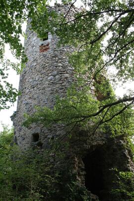
The Gerbolle Trail
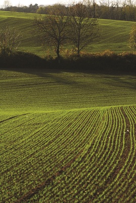
A very hilly route alternating between undergrowth and meadows, offering many remarkable views of the Rhône Valley.
Description
DETAILED ITINERARY:
1 - DEPARTURE
- From the car park, cross the village via the street on the left.
- At the fountain, turn right until you reach the cross.
- Continue straight ahead, pass the house and then descend to the left.
2 - ASCENT TO THE TRACK
- Go up and turn right onto the track.
- At the crossroads at the edge of the woods, turn right until you reach the La Croix des Chasseurs signpost.
3 - ACROSS THE FIELDS
- Pass the house and continue straight ahead across the fields, join the road and follow it to the hamlet of Les Barres.
- Cross the village and turn left onto Chemin du Flachet.
4 - STREAM AND HAMLET
- Stay on the main track, cross the Gerbolle stream and reach the hamlet of La Balme.
- At the crossroads, turn right to reach the Le Télégraphe signpost.
5 - DIRECTION VOSSÈRE
- Turn left towards Vossère, cross the D46 and take the track on the right to the hamlet of Vossère.
- At the Vossère signpost, turn left and go down the road for 100 m before turning left onto the track through the fields.
6 - FOREST AND MEADOW
- Reach the forest and continue left at the meadow.
- Take the road on the right for 100 m, then continue left towards Reventin-Vaugris.
- Pass the houses and take the path on the right into the forest, then turn left onto the second path to reach the road.
7 - RETURN TO MALACOMBE
- Follow the road to the right, then continue left at the fork.
- When you reach the houses, take the Malacombe path.
- On the other side of the valley, go down the Moulin path.
8 - FINAL LOOP
- After the house, turn right onto the path at the edge of the forest, cross the Pont des Amoureux bridge, then turn left and immediately right onto the path that climbs back up to La Croix des Chasseurs.
- Follow the same route as on the way out to return to the car park.
Opening period
From 01/01 to 31/12 daily.
Spoken languages
-
 French
 French
Itinerary
- Marked route NON_DISPONIBLE
- Route type BOUCLE
Equipment
- Car park
Documents
Prices
Free access.