
Le col de la Fromagère
Between Drôme and Hautes Alpes, this charming 46 km, 865 m ascent loop takes you around the Aiguilles and Raton mountains. The Col de la Fromagère offers panoramic views of the hidden Pommerol valley.
Description
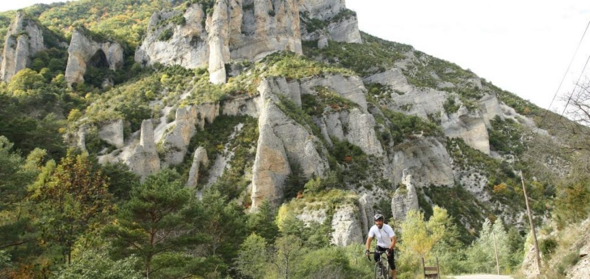
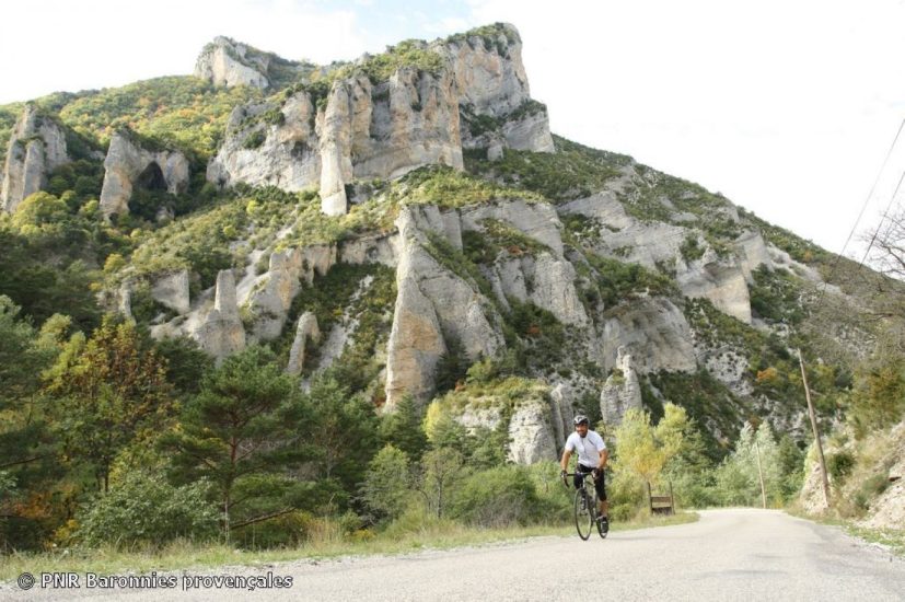
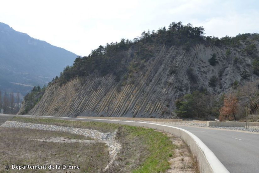
First you'll reach the small village of Verclause, then climb up to Rosans, where you can appreciate the 12th-century Tour Carrée around which this medieval village was built. A small road then takes you to the Col de la Fromagère (1,072 m alt.), with its passage through beech forest and its arrival at the panorama of the hidden Pommerol valley. The north-facing slope takes you through a wild landscape where limestone and erosion have combined so well that "fairy chimneys" still stand out in long silhouettes. Your route then heads east again, past the 16th-century Château de La Charce and the no less famous limestone strata of the Serre de l'Âne (a world-renowned geological site). Ideal season: September.
Opening period
All year round daily.
Spoken languages
-
 French
 French
Itinerary
- Marked route BALISE
- Route type BOUCLE
Documents
Prices
Free access.