Hiking between the Rhône and the vineyards: Tupin, Condrieu, Semons
This hike lets you discover the Rhône’s river banks in the protected area of Ile du Beurre, the old part of the village of Condrieu and beautiful viewpoints of the market gardening plain of Ampuis and the steep vineyards of Côte-Rôtie.

Description
From the car park, cross the Lyon road, go around the chapel, then take the Lyon road for a few metres to the South (towards Condrieu). Immediately, take the small road that goes down to the left (Chemin des Gravières), pass the railway tracks and continue on this small road (Chemin de l'île de la Chèvre). At the end, turn right, going along the river bank.
1- Take the bridge on the right which crosses this tributary and continue on the track which follows the other bank of the tributary. When there is a choice between the ViaRhôna and the pedestrian path, choosing the latter, you enter the protected area of Ile du Beurre.
At the end of the path, pass over a bridge that spans the Bassenon stream, just before its confluence with the Rhône. Turn left off the bridge to reach a kind of promenade that serves as a nature observatory.
2- Continue along the right bank of the Rhône (towards the South). Pass between a campsite and the Rhône. A little before the end of the campsite, you’ll discover the river port of Roches-de-Condrieu on the other bank.
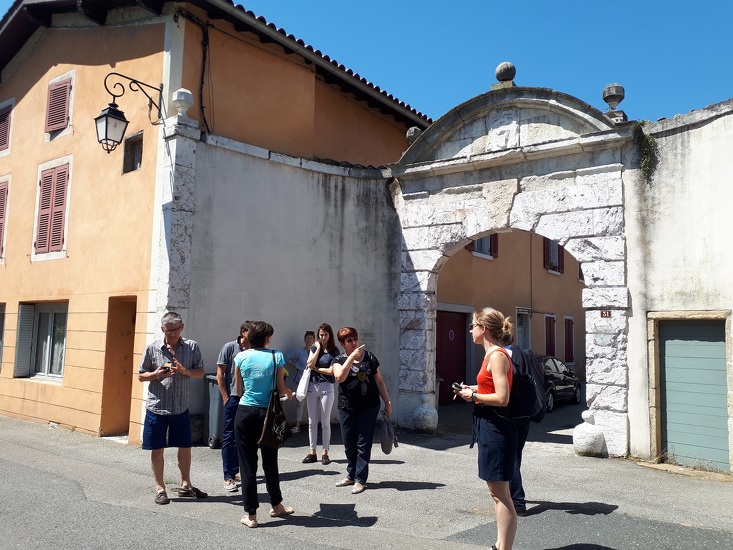
At the entrance to Condrieu, after a large coloured house (pink), turn right to go down about twenty metres to Place du Razat (restored houses), then go back to the quay. At the next street (Rue du Grand Port), do the same (restored houses) and then return.
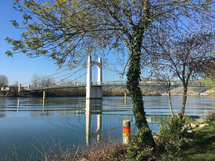
You arrive at a very pleasant place at the edge of the Rhône, pass under the bridge which spans the Rhône and continue onto the quay.
Take the first right, Rue de Sauze, and immediately left to follow the Rhône quay again.
3- After 2 big plane trees, turn right (at a right angle), Place du Raffour. This small street looks like a dead end, go to the end and take the narrow passage between a house and a large stone wall, continue on this passage which turns right then left. Pass under the small stone railway bridge. Continue straight on Rue Henri Barbuse, cross the RN86 and continue straight on Rue du Marché aux Fruits.
4- Just before the brook, turn right onto Rue Eugène Genet, then first right into Rue de la Croix and first left into Grande Rue.
Take the covered passage on the left into Rue Saint-Martin (just after No.22), and when you arrive at Place du Marché, turn right and follow Rue de Belfort.
Take the second left, Rue Saint-Étienne, which goes up under the town’s old fortification gate. Then take the first street on the left, until you reach Rue de la Visitation.
Take this covered passage, then the first passage on the right, where you find Place du Marché, take a right to cross the Arbuel stream and immediately after the bridge, turn right onto Rue Claude de Villard.
At the junction with Montée de la Caille (dead end sign), take the bridge on the right, and go straight on to Rue Ecorcheboeuf. At the end of the street, turn left twice to take the Montée des Recollets.
At the cemetery, go down Montée de la Tour, which runs alongside the cemetery on the right. When you reach the D28 (Montée du Rozay), go up for about 20 metres and then turn right on a pedestrian path, Rue de la Croix de l'Oiseau.
5- At the crossroads (4 roads), turn left on Rue Cuvillière, then the first right onto Rue de Croyez. When you reach the RN86, turn right and then immediately left into Allée de la Bachasse, which you follow until you reach the banks of the Rhône. On the left, take the path that follows the river, follow the direction "Retour vers collège de Bassenon", follow the stream to pass under the RN86 road and the D124. When the path arrives at paved parking, turn left twice. Turn back at the traffic roundabout and take the D124 for fifty metres. Just after the stream, at the Condrieu sign, turn left and immediately right onto the marked mountain bike (VTT) path.
6- At the Bassenon road, go up via the road on the left, which offers beautiful views of the valleys behind Condrieu. The road makes a hairpin to the right, and you’ll find the path marked VTT on the left.
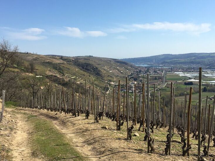
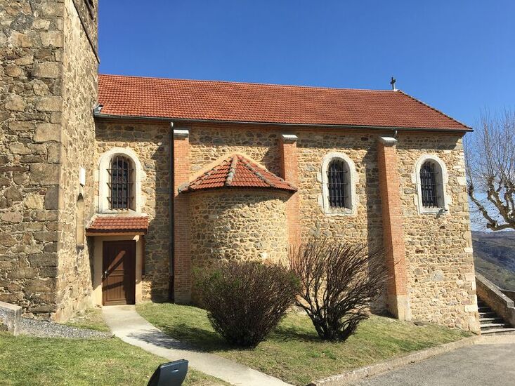
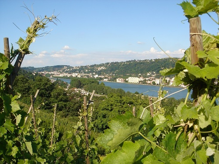
7- Continue on this mountain bike track until the village of Semons, head for the belvedere by Chemin du Belvédère (see the view over the market gardening plain of Ampuis, almost to Vienne). Walk all the way around the church, and behind the church, pass under a porch to take the wide path on the left (not marked) that starts to descend into the vineyards.
8- Take the first track on the left, which goes back to the road (D124). Turn right and go all the way down by the road to enjoy the terraced vineyards, keeping a very clear view of the plain.
At the bottom of this road, arriving at the D386 (old RN86), you’ll find the car park where you started.
Opening period
All year round.
Itinerary
- Marked route NON_BALISE
- Route type BOUCLE
Equipment
- Car park
Environments
- In the country
- Village centre
- View over the vineyards
More informations
69420