Black Milan trail

On the track on the black kite, come and dicover the wealth of the Rhône valley: view on the regional park of the Pilat, vineyards of Côte-Rôtie and Condrieu.
Description
1- At the town hall car park, go along the wall south of the château, and turn left onto Chemin Champ-Sever. It turns to the left and reaches Chemin de Saint-Laurent, which you should follow.
> Variant via Allée des Tilleuls: at the town hall car park, walk along the old stables towards the church, walk around the walls of the château, then turn right on a path to Chemin de Saint-Laurent.
2- Continue on the path going up to the right (marker C; troglodyte cave). At the next crossroads, take the dirt road opposite.
3- On the plateau (view of the Alps and Crêts du Pilat), turn left on the road up to the water tower, then right on Chemin de l’Abri. At the post "Château d'eau", follow "Gerbey" to go down towards the Rhône.
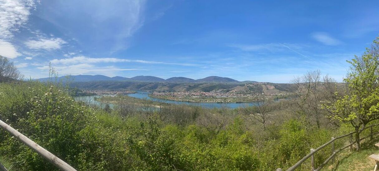
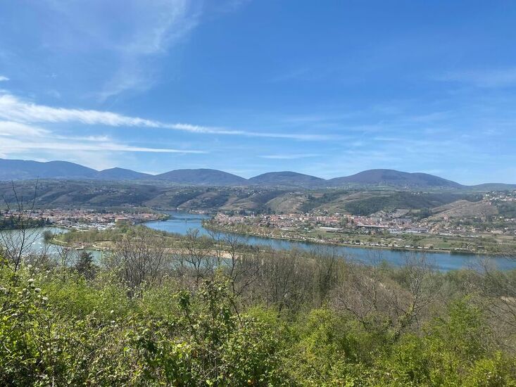
4- At the crossroads, towards the boulders, take the path Chemin de l'Escadron, along the belvedere (panoramic view of Condrieu, Les Roches de Condrieu, the leisure centre and the Ile du Beurre), which goes down into the forest.
5- At the bottom, take on the left the track along the railway (be careful with children for 750 m).
6- At the "Gerbey" post, go up to Chonas by the Chemin de Bellevue, then the stabilised track (M marker).
7- At the belvedere (orientation table facing the famous vineyards: Côtes du Rhône, Côte-Rôtie, Condrieu), continue the climb. Reach the agricultural plateau (marker A).
8- At the road on the plateau (Chemin des Grandes-Bruyères), turn left, then right, on Chemin du Berbin.
9- At the "Berbin" post, turn left on the stabilised track, following Chonas. Pass the centuries-old mulberry trees (marker S) and houses built of adobe (marker P). Cross Chemin du Marais. At the next junction, turn right to walk along the cemetery. At the end of the car park, go down the path leading to Chemin de la Roux; turn left to the village.
Observations:
> Beware of crossing busy roads, no horse riding is allowed along the lake.
> In Chonas-l'Amballan, the name "chemin" designates village streets, paths and dirt roads.
Things to see:
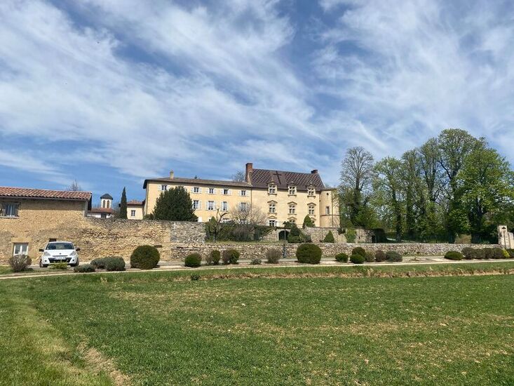
at Roches de Condrieu: the grain market and church in Chonas-l'Amballan: the château, fountain and wash house.
in Gerbey: the reed bed and alluvial forest.
Opening period
All year round.
Spoken languages
-
 French
 French
Itinerary
- Marked route BALISE
- Route type BOUCLE
- Nature of the land Ground Grit
Equipment
- Picnic area
Services
- Pets welcome
Environments
- In the country
- Village centre
- Panoramic view
Documents
More informations
38121