
Stroll through the historical centre of Vienne

This walk in the historical centre of Vienne lets you discover the town’s main sites. Passing along the Pipet belvedere involves a good climb, but offers a splendid view of the town, the Rhône Valley and the Pilat.
Description
Duration: approximately 3-4 hours
Difficulty: easy to moderate, some uphill sections
Starting point: Vienne railway station
DETAILED ITINERARY:
1 - HISTORICAL CENTRE AND SAINT-MAURICE CATHEDRAL
- From the station, take Cours Brillier (left-hand pavement) past the post office to Cours de Verdun / Place des Allobroges.
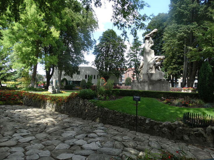
- Turn left and cross diagonally across the central reservation to enter the public gardens.
- Opposite you, admire the statue of Michel Servet (1515-1553). Go around to the left to see a well-preserved section of Roman road.
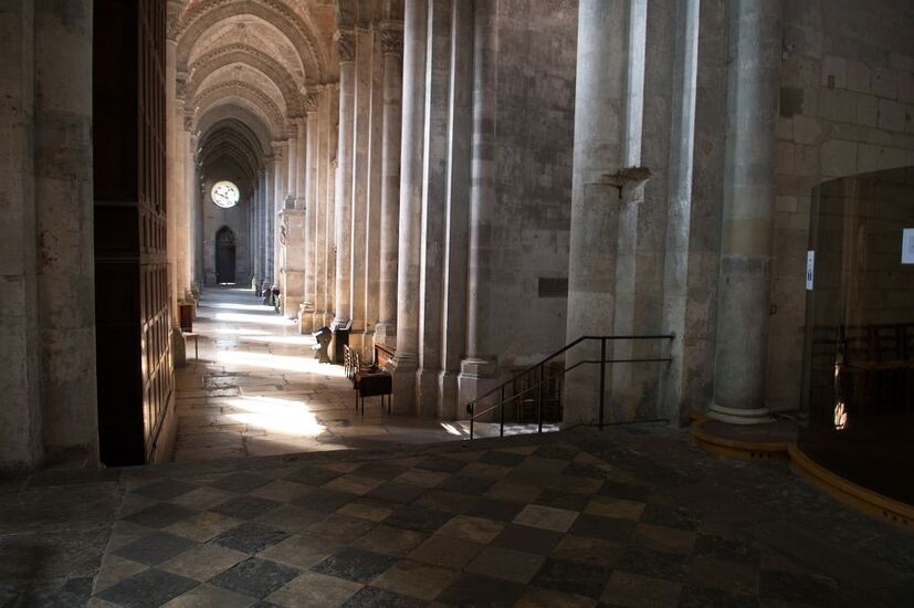
- Exit and return to Cours Brillier, then cross over to Rue Boson, which leads to the foot of the steps of Saint-Maurice Cathedral.
- Climb the stairs and visit the cathedral. The interior, simple but elegant, is well worth a visit.
- Exit and head towards the Rhône via Place Saint-Maurice.
2 - CROSSING THE RHÔNE AND GALLO-ROMAN SITE
- Cross the river on the footbridge to Sainte-Colombe.
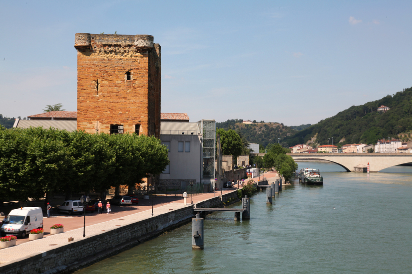
- At the end of the footbridge, take the stairs on the left to reach Quai d'Herbouville, then continue north.
- Pass the Tour des Valois, then climb the pedestrian ramp on the left near the nautical stadium until you reach a large car park.
- Go under the road via a pedestrian tunnel, then immediately climb the stairs on the right to visit the Gallo-Roman site.
- Opposite, the Gallo-Roman museum of Saint-Romain-en-Gal is recommended, especially with children.
- Cross the Rhône again and head to Place du Jeu de Paume, opposite Saint-André-le-Bas Church.
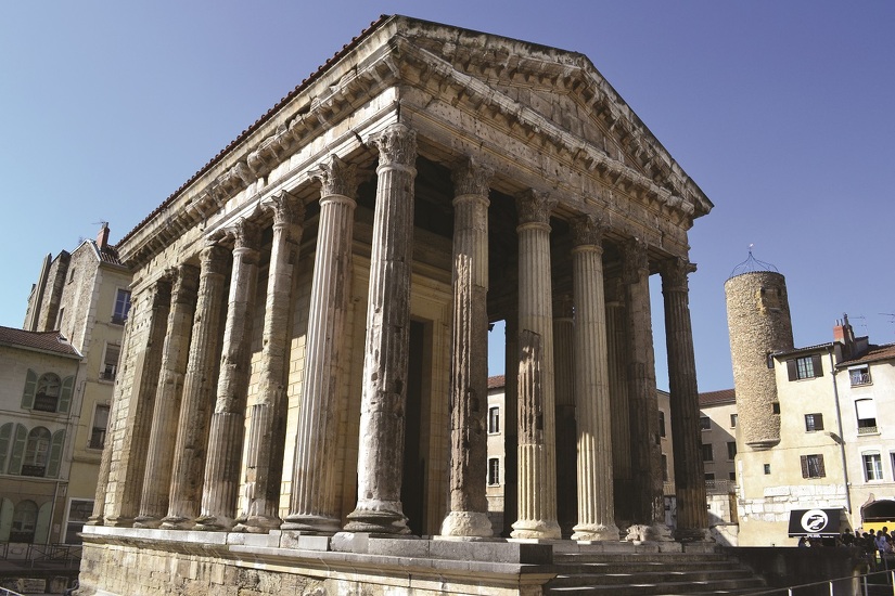
3 - TEMPLE OF AUGUSTUS AND LIVIA AND RENAISSANCE STREETS
- Go up the stairs on the left and walk around the church.
- Take Rue des Clercs (sign: Temple of Augustus and Livia).
- Behind the façades, take a look at the Renaissance courtyards, some of which are protected by digital locks.
- Arrive at Place du Général de Gaulle, where the Temple of Augustus and Livia is located.
- Enjoy the atmosphere of the square, the café terraces and the old bookshop.
- Continue along Rue de la Chaîne, which leads to Place de l'Hôtel de Ville, then turn right onto Rue des Orfèvres.
- Pass Place du Pilori and its Roman ruins, then head towards the Théâtre de Vienne.
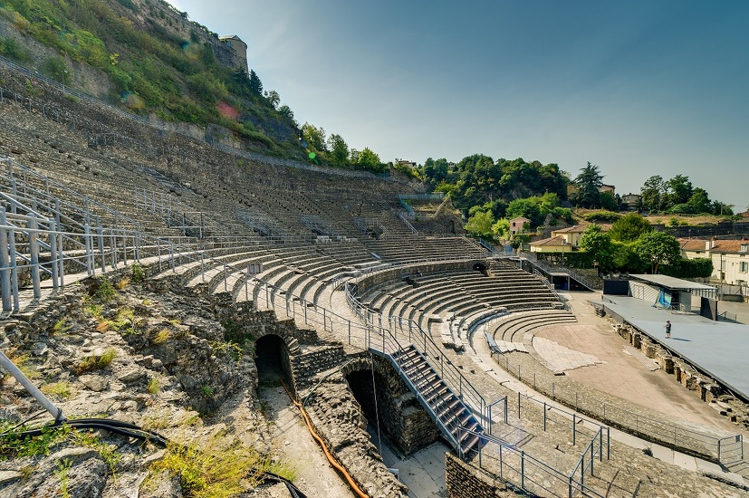
4 - ANCIENT THEATRE AND CLIMB TO PIPET
- Cross Rue Victor Hugo, then take Montée Saint-Marcel.
- Pass Rue des Célestes and a short staircase that leads to Rue du Cirque, which leads to the Ancient Theatre.
- At the stop sign, take Rue de Pipet. The climb is steep, so take your time.
- On the left is the huge Pipet cemetery; there is a bench where you can take a break.
- Take the first street on the right to reach the Belvédère de Pipet.
5 - BELVÉDÈRE DE PIPET AND PANORAMA
- From the esplanade, enjoy an exceptional view of Vienne, the Rhône valley, Pilat and the Monts du Lyonnais.
- Return to Rue de Pipet, then take Chemin des Amoureux (be careful, it's discreet): a slight climb followed by a steep descent to Montée Saint-Marcel.
- Cross over and continue along Montée des Tupinières, then Montée Réaumur (downhill).
- Follow the streets to the Montée de Coupe Jarret, cross Rue Victor Hugo, then take the second street on the right (Rue Peyron).
6 - RETURN TO THE STATION
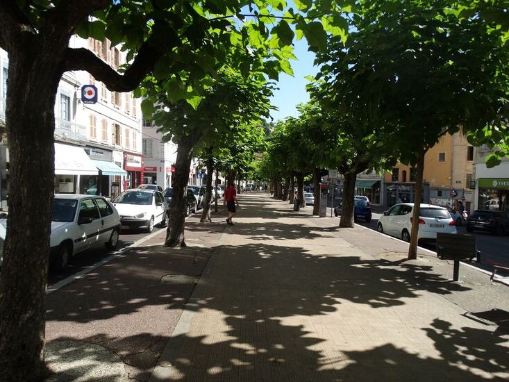
- Come out onto Place de Miremont, turn left, then left again onto Cours Romestang with its tree-lined central avenue, which leads back to the station.
Opening period
All year round daily.
Spoken languages
-
 French
 French
Itinerary
- Marked route BALISE
- Route type BOUCLE
- Nature of the land Hard coating (tar, cement, flooring)
Equipment
- Play area
- Picnic area
- Public WC
- Car park
- Orientation board
- Pay car park
Environments
- Town location
- In the historic centre
Prices
Free access.
More informations
38200