Circuit of the Tower

This loop invites you to discover the natural treasures of Eyzin-Pinet, walking through its hillsides where orchids abound, and to explore its historical heritage with the Pinet tower, a remnant of a 12th-century castle.
Description
Duration: approximately 1 hour 45 minutes.
Distance: 5.7 km (short loop option)
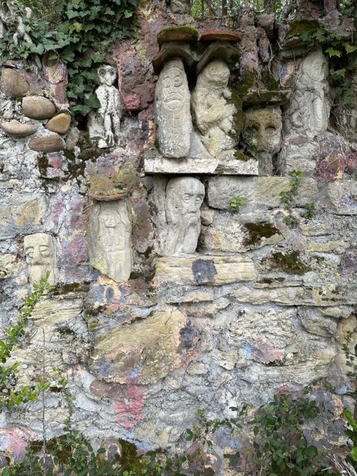
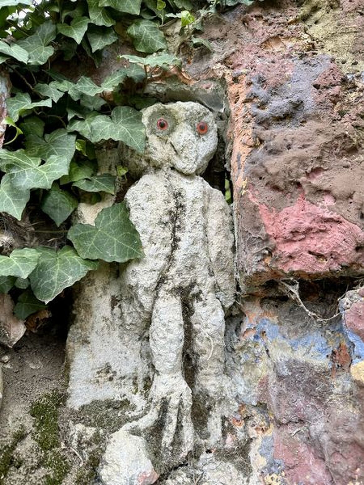
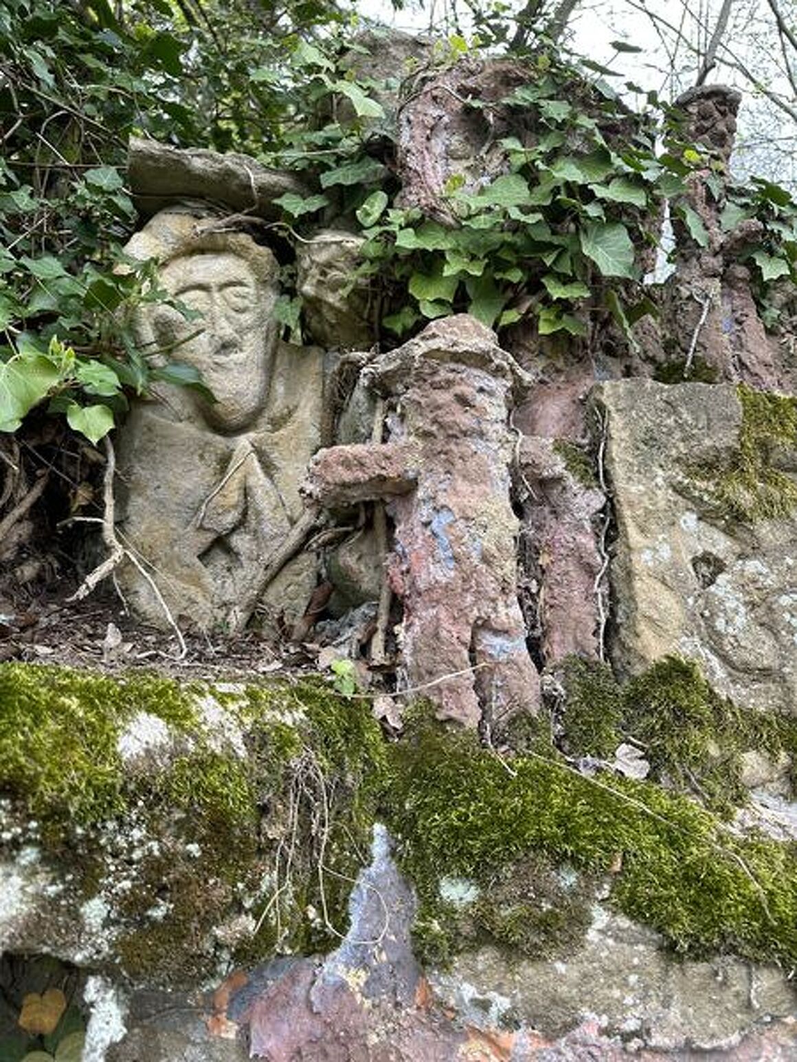
Points of interest: Tour de Pinet, Blaches national forest, Combe de Vaux, art brut wall.
DETAILED ITINERARY:
1 - START
- Walk alongside the tennis courts along a path leading up to the ‘Le Salin’ signpost.
- Turn right and continue to the ‘Chez David’ signpost.
2 - CLIMB INTO THE FOREST
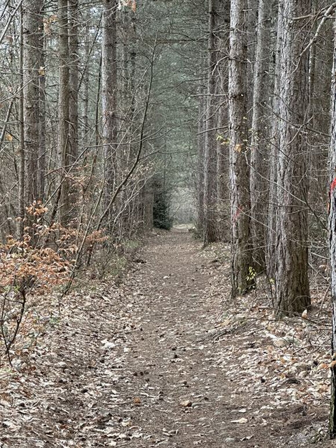
- Turn left and climb the hill via a track entering the Blaches national forest.
- At the intersection with a forest path, turn right until you reach the D538 at the L'étang des Blaches signpost.
- Turn right, then immediately left onto the road towards Montseveroux.
3 - POND AND DIRECTION OF PINET
- Take the wide track on the left that runs alongside a private pond.
- Pass the Les Blaches signpost and continue straight ahead.
- At the second signpost, turn left towards Pinet.
- After crossing the road twice, you will reach the Tour de Pinet signpost.
Short loop alternative: descend to the foot of the tower, continue to the hamlet of Pinet, then turn left onto a track to return to the Le Salin signpost.
4 - CRÊTES AND COMBE DE VAUX
- Turn right to the Les Crêtes signpost, then turn left onto a stony path descending the hillside.
- Join a road, turn right to the end, then continue on a wide path through the woods.
- Continue along the hillside, on the edge of the Combe de Vaux (Sensitive Natural Area), until you reach a partially tarmac track and a hamlet.
- Climb up to the Le Paviot signpost.
5 - TOWARDS EYZIN-PINET
- Descend to the D41 at the Thibaud signpost, turn right and, just after a bridge, take a left onto a farm track leading to the Gère stream.
- Ford the stream and continue straight ahead to reach the hillside, then follow the road to the left.
6 - TRAILS AND HAMLETS
- After passing the houses, follow the trail along the ridges, descend onto a road crossing a hamlet, then take a wide grassy path on the right at the dead end until you reach the La Garde signpost.
7 - RETURN TO EYZIN-PINET
- Turn left, cross a road, then continue along a wide stony path. Walk alongside a poplar grove and cross the Gère again, joining a road on the hillside.
8 - FINAL CLIMB
- Take the path opposite which climbs up to a road, follow this road to the right until you reach an intersection.
- Climb up the Chemin du Colas, pass the houses, then turn left onto a path through a meadow.
- Go around an isolated building on the right to reach the Chez David signpost.
- Then return to the starting point via the same route.
ADVICE:
- Take care when crossing busy roads.
- Respect crops and private property.
SIGHTS:
- The Pinet Tower.
- The Blaches national forest.
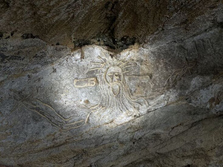
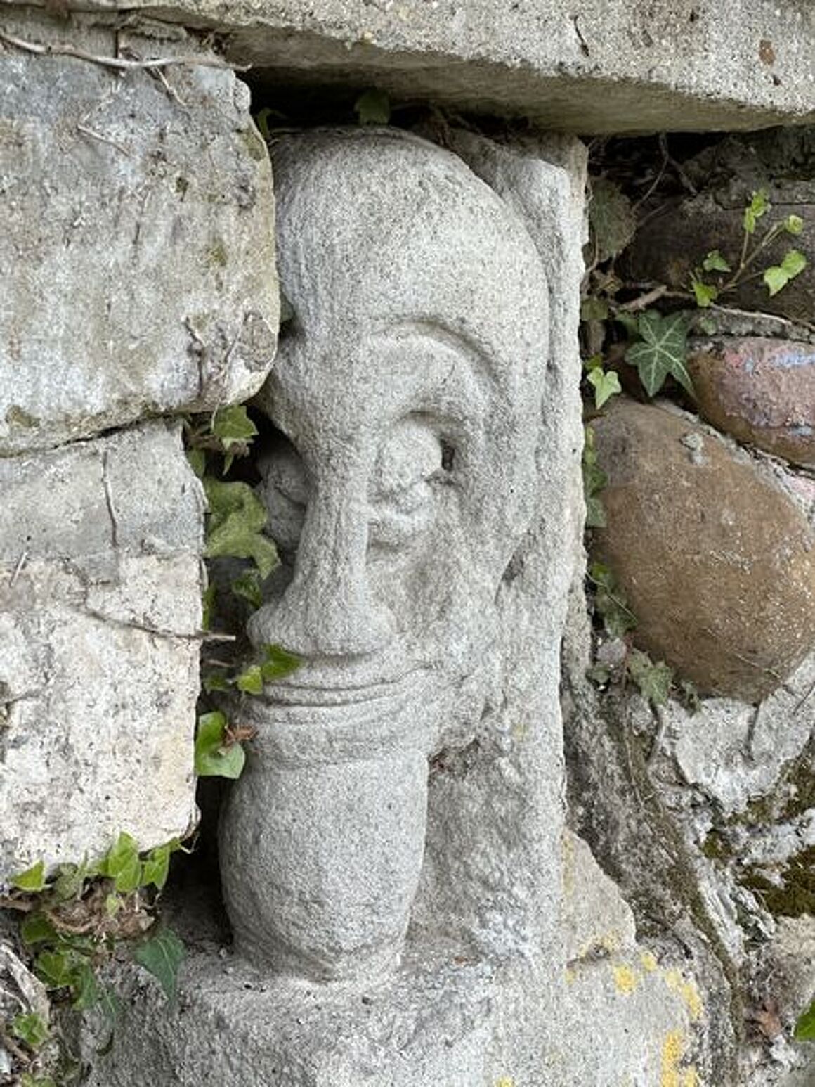
- A wall of outsider art created in the 1980s by a snake hunter.
Opening period
All year round daily.
Spoken languages
-
 French
 French
Itinerary
- Marked route BALISE
- Route type BOUCLE
Equipment
- Picnic area
Services
- Pets welcome
Environments
- In the country
- Village centre
Documents
More informations
38780